Projects Neighborhood Development High Bredeney, Essen
Projects

Neighborhood Development High Bredeney, Essen

Urban Living Amid Greenery

Project Type Redevelopment, Neighborhood Development Construction Volume Site Area 90,600 m², Gross Floor Area approx. 185,000 m², 15,500 apartments, 77,500 qm of commercial space Client ENO Capital GmbH & Co. KG, represented by KRUSE GmbH Architecture kadawittfeldarchitektur Landscape Architecture Kraft.Raum. Energy and Mobility Concept Arup Interdisciplinary Qualification Process 2025 – 1st Prize

Letter Revitalization of the Former Police Academy Site into an Urban Neighborhood | Added Value The new neighborhood is being planned to be climate-resilient, built using sustainable construction methods, and featuring a variety of community spaces.

Integration of the neighborhood into its surroundings.

“Former Police Academy” Neighborhood Development, Essen | Germany  On the approximately 90,600-square-meter site of the former police academy, just a 15-minute drive from downtown Essen, a new urban neighborhood is taking shape, featuring approximately 1,500 apartments and 77,500 square meters of commercial space, all built using sustainable and climate-friendly construction methods. The inclusive mix of unit types offers a variety of housing options for different generations, lifestyles, and income groups, fostering a socially diverse neighborhood community.

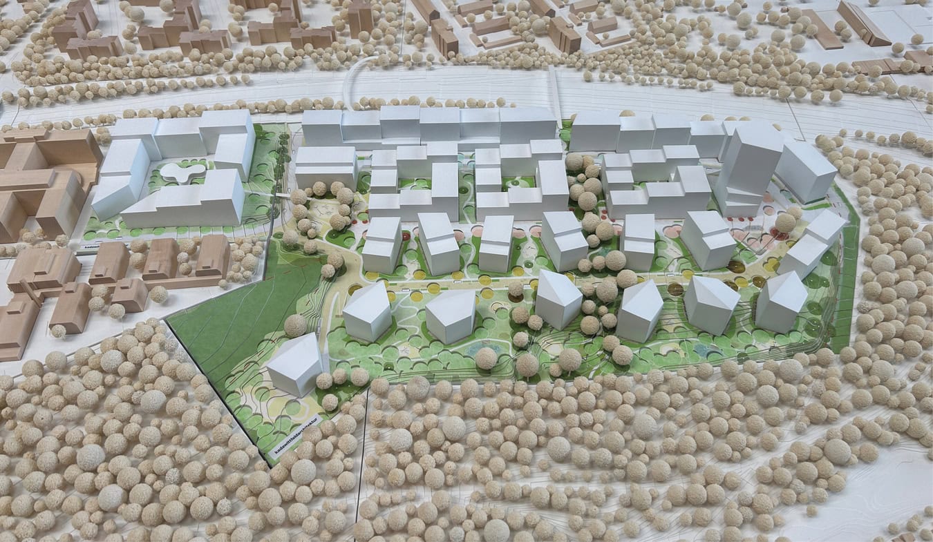
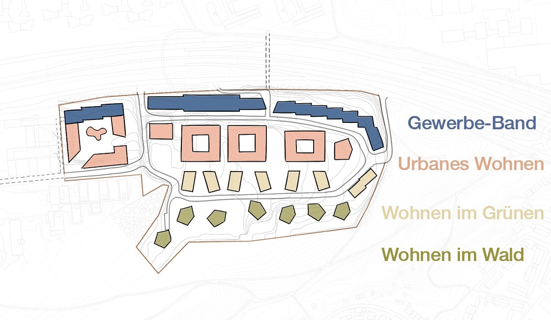
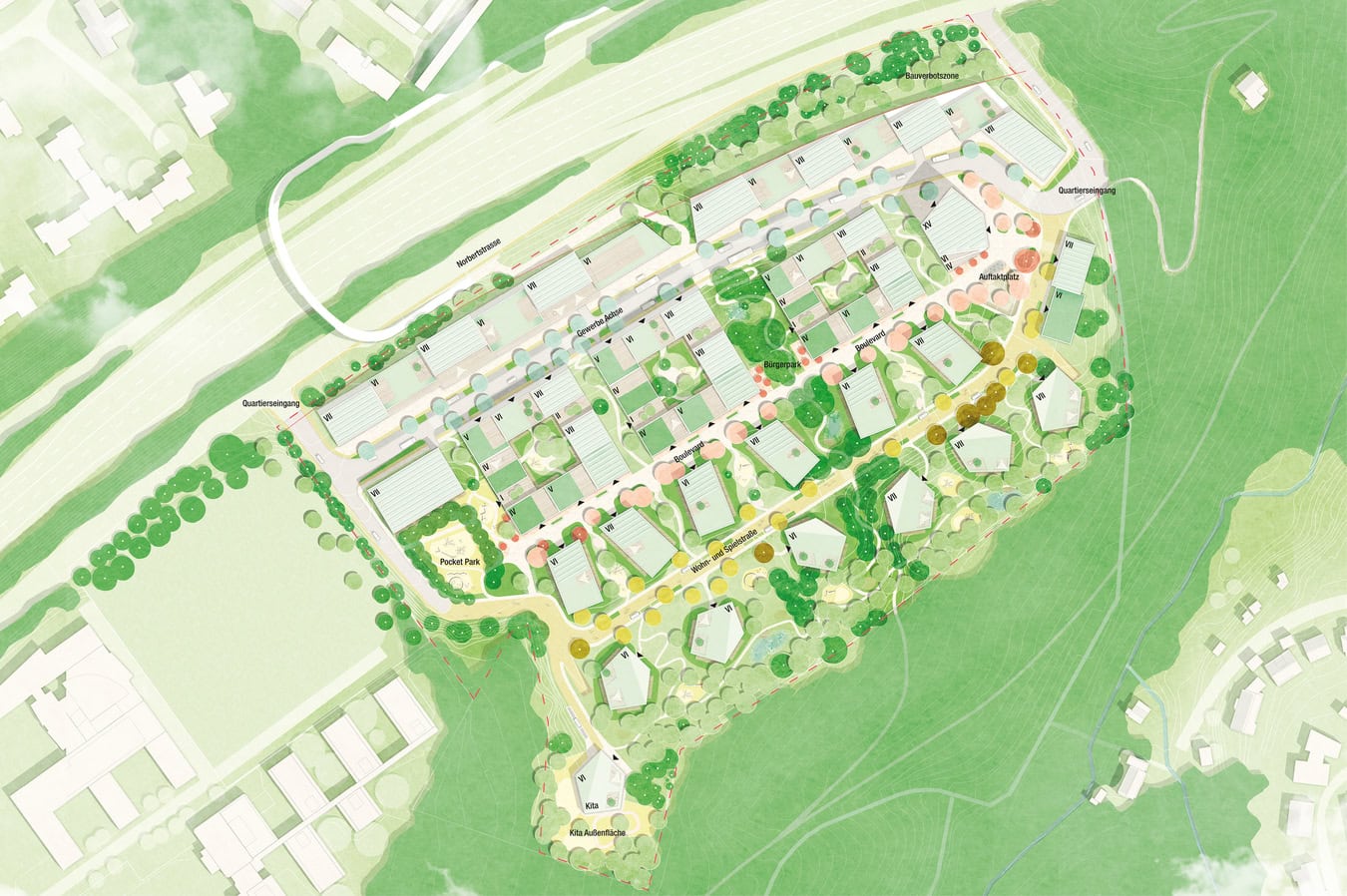
The site, with an eight-meter elevation difference running east to west, is nestled between the A52 federal highway to the north and the “Beckmannsbusch” green corridor to the south. The design responds to these varying characteristics by dividing the area into four zones: In the north, a closed commercial axis shields the neighborhood from noise pollution. This is followed by an urban mixed-use axis, then by two zones reserved for residential use. At the same time, the development becomes increasingly small-scale and open—the neighborhood connects with the forest to the south, making it an integral part of the neighborhood.

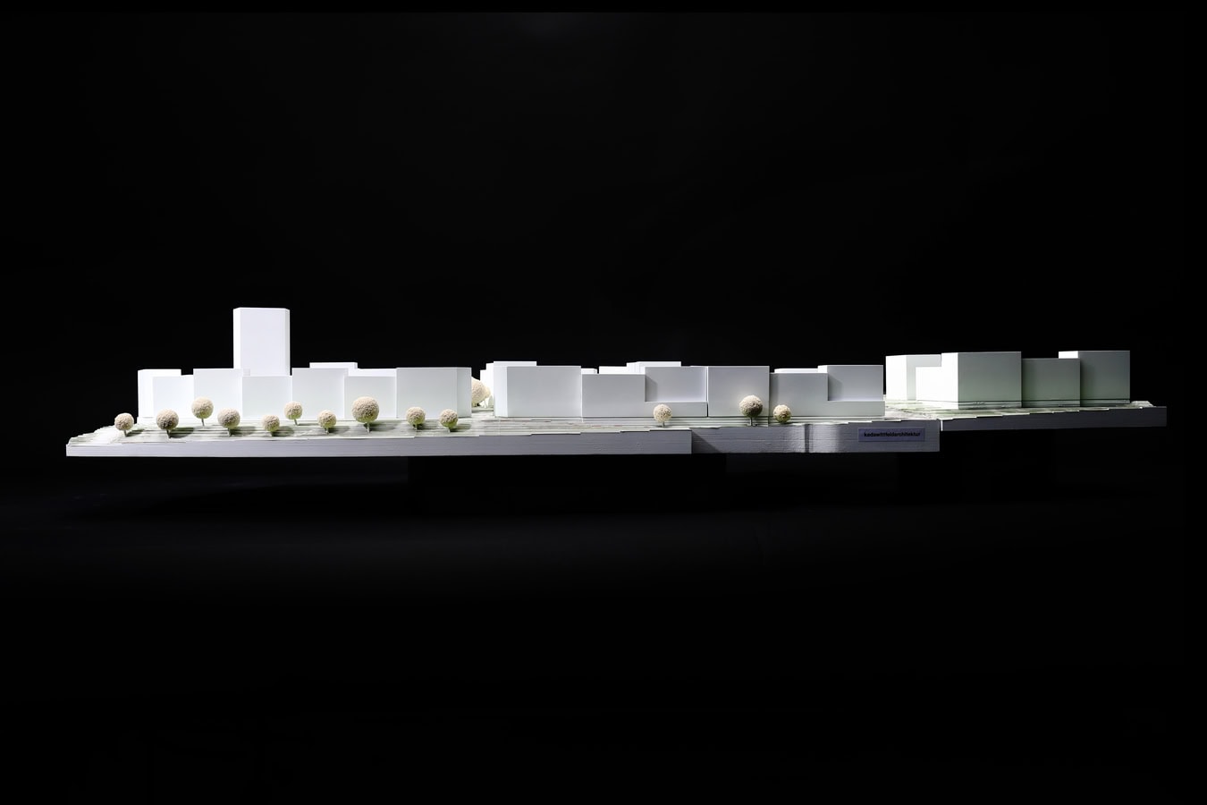
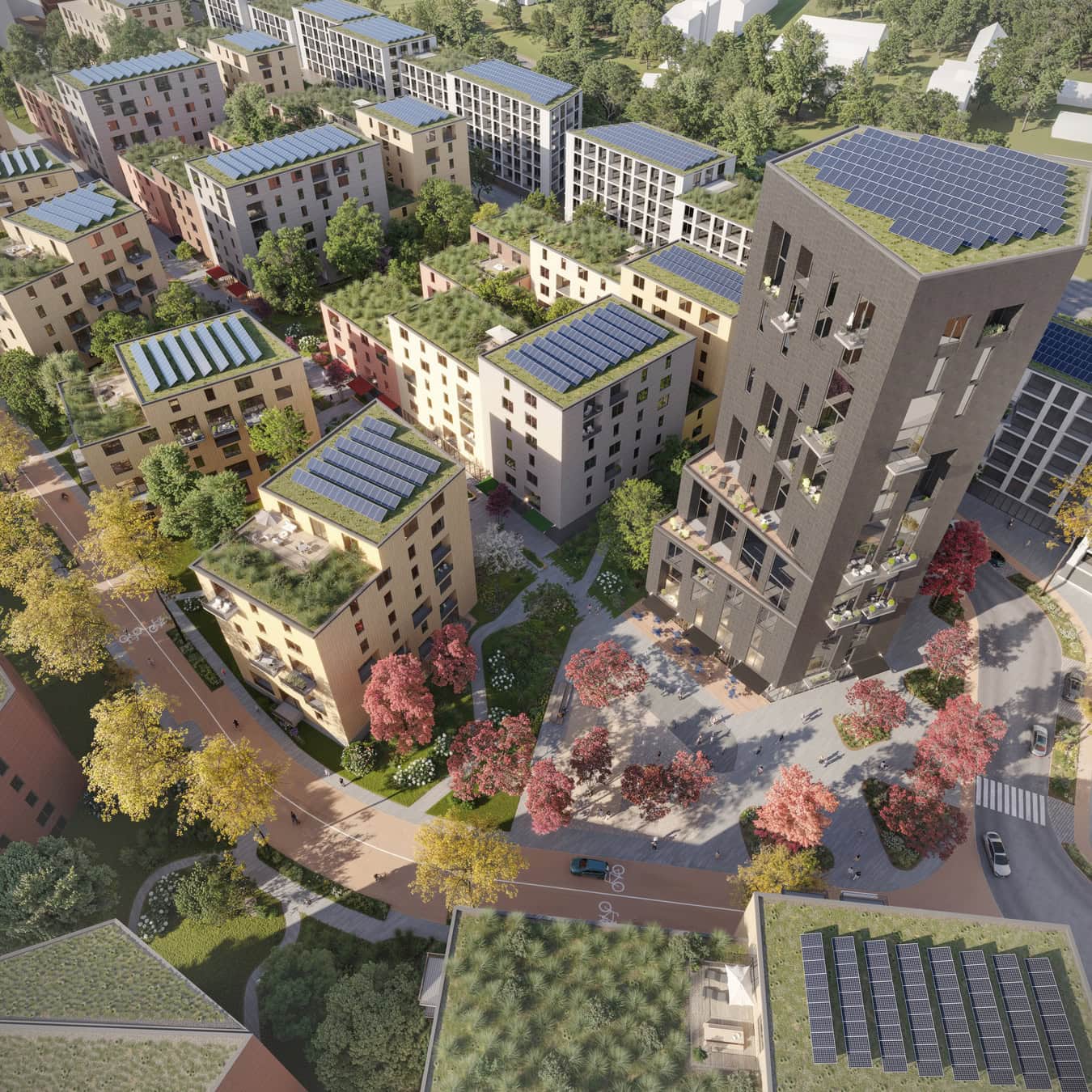
The development ranges from a commercial strip along the A52 to a low-density residential area near the forest.

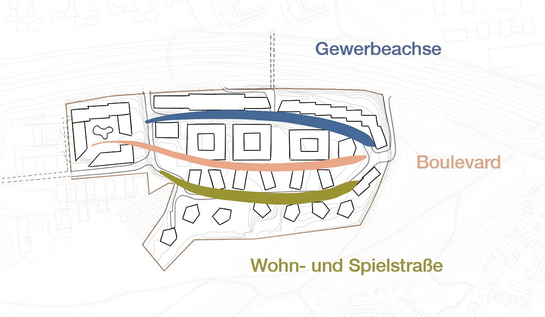
Three distinct access routes run through the neighborhood.

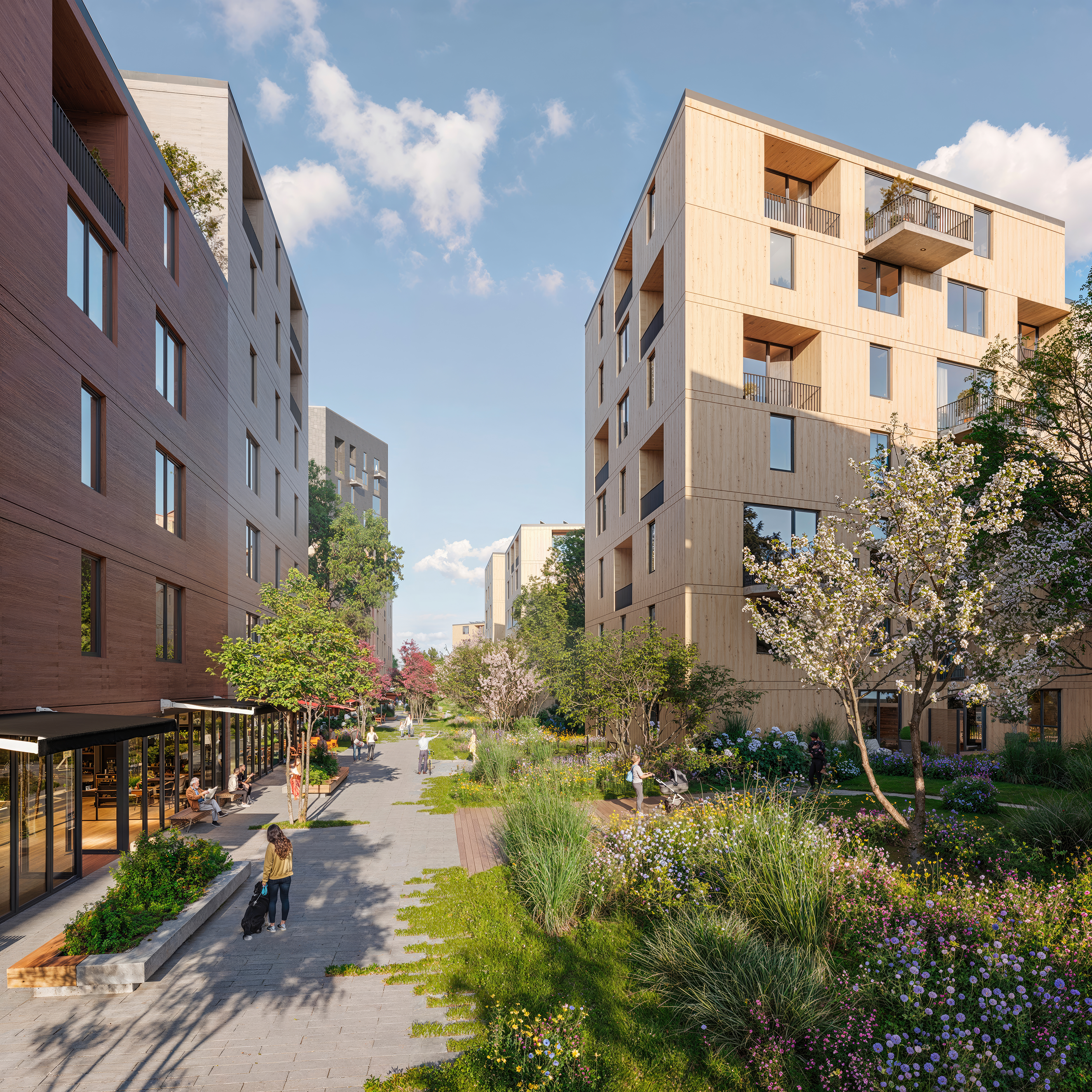
Together with a series of squares, each with its own unique atmosphere, the boulevard forms the backbone of the neighborhood.

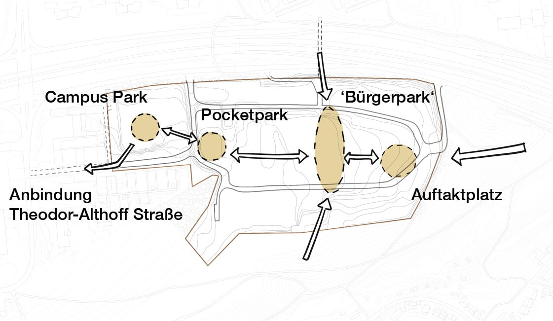
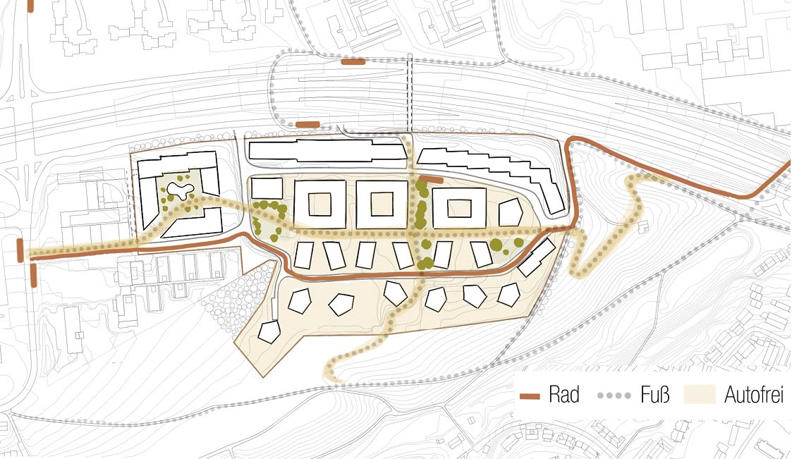
The neighborhood will be integrated into the regional network of walking and biking trails.

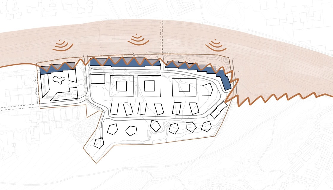
The commercial zone protects the neighborhood from noise pollution from the A52.

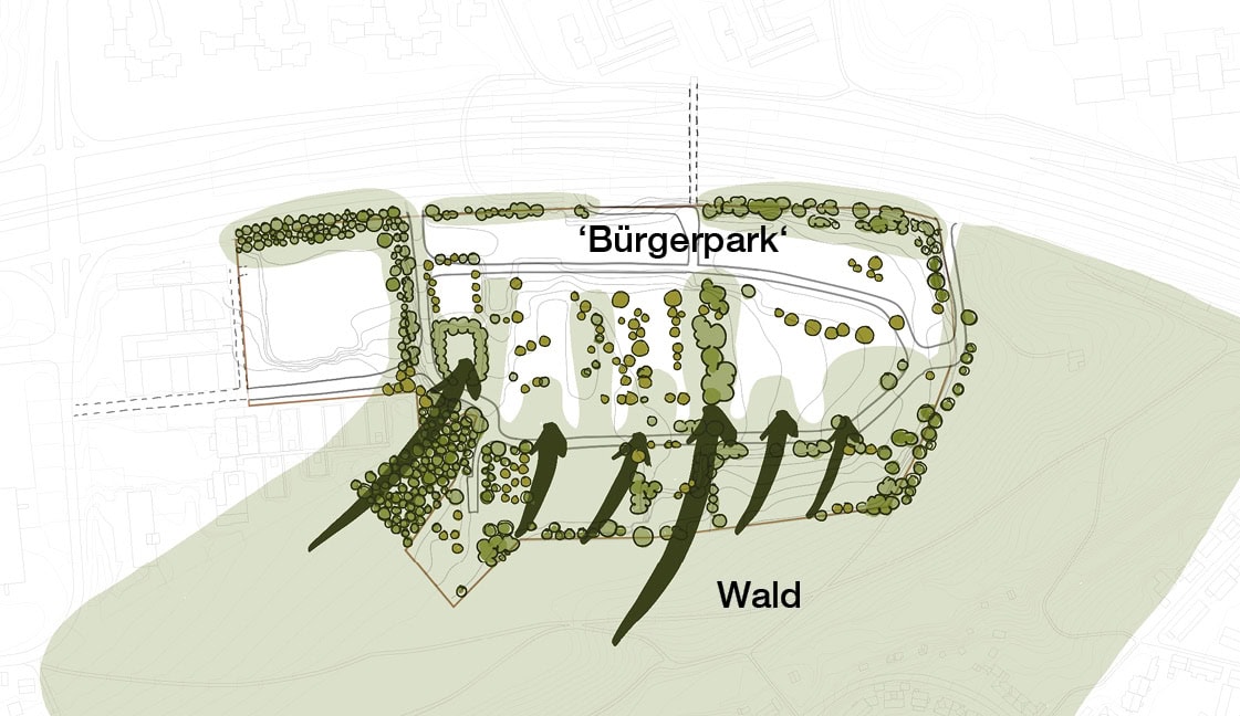
The greenery of the forest will be incorporated into the neighborhood, and the existing trees will be preserved as much as possible.

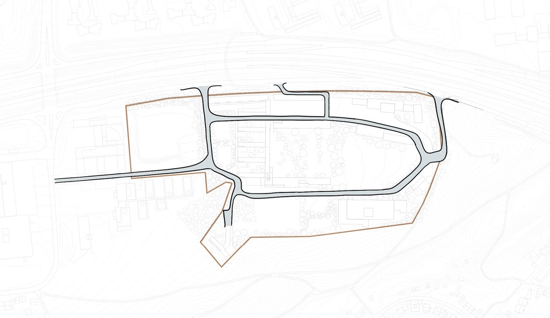
The new access loop is based on the existing roads and retains the current access points, thereby minimizing earthwork.

From north to south, the development pattern becomes increasingly fragmented and granular—starting from the compact commercial corridor along the A52, which shields the area from noise pollution, the neighborhood gradually blends into the forest as it extends southward.

The commercial corridor along the highway shields the neighborhood from noise pollution and, with its varied design, creates a diverse visual landscape.

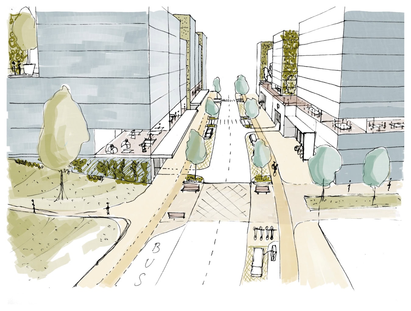
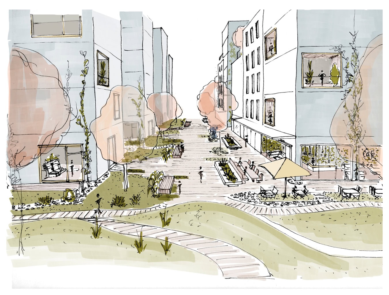
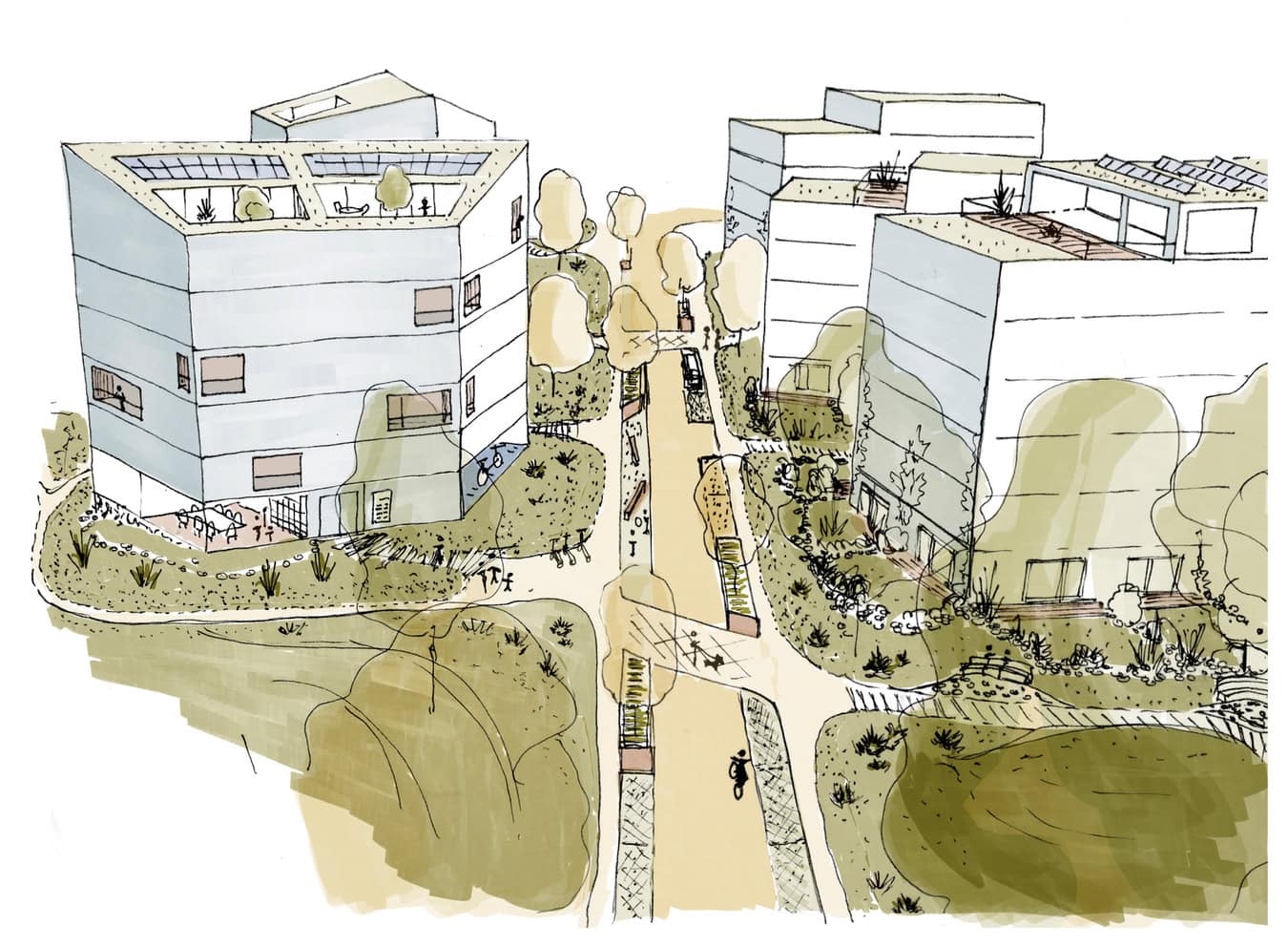
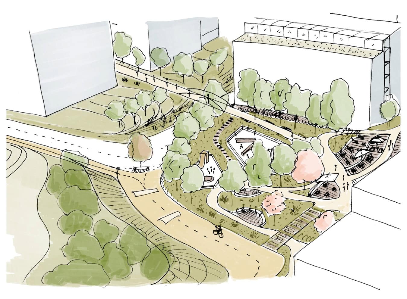
The existing property access roads and the service loop will be retained, thereby avoiding costly additional earthwork in the rugged topography. At the same time, the zoning of the development allows for a distinct, clearly hierarchical access concept consisting of three axes that run through the neighborhood in a west-east direction between the zones. The northern “commercial axis” provides access to the offices and commercial units. It serves as the main logistics route; the entrances to the offices’ underground parking garages are located here, and public transportation runs along it. The central boulevard forms the “lifeline” of the neighborhood. Car-free and integrated into the regional pedestrian network, it stretches between the urban, bustling neighborhood square in the east and a pocket park framed by existing trees in the west, which serves as an inclusive gathering place offering recreational opportunities for people of all ages. In between, a variety of additional public spaces with different atmospheres and amenities are being created, inviting people to meet, play, and linger. Cafés and restaurants on the ground floors, shops for daily necessities, and a local grocery store further enliven the boulevard. To the south, a traffic-calmed street provides access to the residential buildings and extends the regional bicycle path network.

The existing green spaces also influenced the neighborhood’s layout; they have been preserved as much as possible and expanded into a “public park” in the center of the neighborhood. This park also serves as a pedestrian and bicycle connection between the forest and the highway overpass.

Commercial corridor with offices and mixed-use development

A central, car-free boulevard with cafés and shops on the ground floor and a variety of gathering places and outdoor seating areas

A traffic-calmed residential and play street

The Pocket Park—inclusive for everyone—whether big or small, young or old

In addition, the development was optimized using simulations to ensure optimal wind comfort, microclimate, and sunlight exposure. The cold-air corridor for Essen’s downtown remains unobstructed, heat islands are avoided, and good natural lighting is ensured for all areas. The pentagonal shape of the high-rise reduces wind turbulence, and its stepped design prevents downdrafts at ground level as well as on the terraces.

A neighborhood-specific, geothermal-powered local heating network supplies the neighborhood with sustainable heat. PV panels on the roofs and facades generate electricity for the heat exchanger and for electric mobility. In addition, the neighborhood’s own electricity is made available to residents as part of a tenant model.

The starting plaza marks the urban, eastern starting point of the central boulevard.